Read MapInfo File
This option will read in a MapInfo .MIF and MID file into the job.
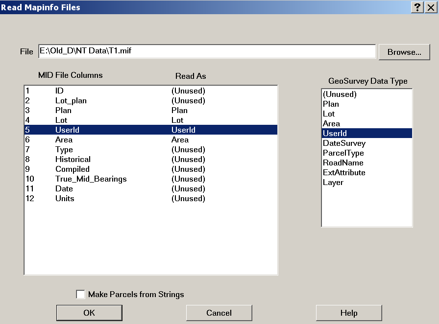
Use the Browse button to select the data file
There are two windows under the File selection window.
The left one displays the names of the data items which are held in the .MIF file.
The right one shows the data types which can be used in Geosurvey.
To allocate each MIF data item to a GeoSurvey data item, select the geosurvey item with the mouse, then click on the MIF item.
String names will be in the form lot/plan.
If a lot name is not available for a lot, but a road name is present, the road name will be used.
If the "Make Parcels from Strings" box is ticked, parcels will be fabricated from the string data.